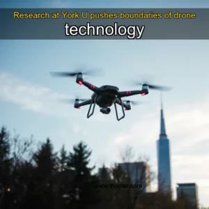
The Science Behind Precision: Mastering Drone Navigation Systems
In an era where drones are transforming industries from agriculture to delivery services, understanding drone navigation is not merely beneficial—it’s essential. This exploration delves into the intricate world of drone navigation systems, revealing how these sophisticated machines maneuver through complex environments without human intervention.
From GPS-based positioning to advanced obstacle avoidance algorithms, modern drones employ a blend of technologies that enable them to perform tasks with remarkable accuracy. As we unravel the layers behind drone navigation, you’ll gain insight into both the technical marvels at play and their practical applications across various fields.
Understanding Core Components of Drone Navigation
Drones rely on a combination of hardware components and software algorithms to navigate effectively. At the heart of any navigation system lies the Global Positioning System (GPS), which provides location data by triangulating signals from satellites orbiting Earth. However, relying solely on GPS can lead to inaccuracies due to signal interference or environmental factors such as tall buildings or dense foliage.
To overcome limitations inherent in standalone GPS usage, many modern drones incorporate additional sensors like accelerometers, gyroscopes, magnetometers, and barometric altimeters. These devices work together to provide real-time information about altitude changes, orientation shifts, and movement dynamics—ensuring precise control even when satellite signals become unreliable.
- Sensors: Accelerometers detect linear acceleration while gyroscopes measure rotational velocity; collectively they help maintain stability during flight operations.
- Barometric Altimeters: Measure atmospheric pressure variations to determine elevation accurately—an invaluable tool when flying over uneven terrain.
A crucial element often overlooked but equally vital is the onboard computer responsible for processing sensor inputs and executing commands issued via remote controllers or automated scripts. This central processing unit (CPU) acts as the brain of the drone, constantly analyzing vast amounts of incoming data from various sources before making split-second decisions regarding direction changes or speed adjustments.
Moreover, advancements in machine learning have introduced predictive capabilities within some high-end models capable of identifying patterns in flight behavior based on historical performance metrics. Such innovations significantly enhance safety margins by allowing preemptive course corrections rather than reactive measures alone.
Advanced Technologies Driving Modern Drone Navigation
As technological boundaries continue expanding rapidly, new methodologies emerge continuously aimed at improving precision levels achieved by contemporary unmanned aerial vehicles (UAVs). One notable advancement involves integrating LiDAR technology into commercial-grade drones used primarily for mapping purposes or surveying hazardous areas deemed inaccessible otherwise.
LiDAR functions similarly to radar except instead of radio waves it utilizes laser pulses emitted toward targets then calculates distances using reflected light returns. This enables creation highly accurate three-dimensional maps depicting surface features down millimeter resolutions—ideal applications include urban planning initiatives requiring minute-level spatial awareness.
Beyond optical scanning techniques lie another frontier known as Visual-Inertial Odometry (VIO). By combining visual input captured through cameras alongside inertial measurement units containing tri-axis accelerometers plus rate gyros, VIO systems achieve robust localization solutions independent of external references altogether. Consequently, this allows operation under challenging conditions where traditional GNSS receivers fail completely.
Additionally, recent developments surrounding artificial intelligence particularly deep neural networks show promising results towards achieving autonomous decision-making abilities inside autonomous flying platforms. Through extensive training regimens involving millions upon billions simulated scenarios, AI-driven navigation modules learn optimal pathways avoiding obstacles dynamically adjusting routes mid-flight according to changing circumstances.
Integration Challenges & Solutions
Despite significant progress made thus far several challenges remain unsolved concerning seamless integration among disparate subsystems composing today’s multifunctional drones. Compatibility issues arise frequently whenever attempting upgrades onto existing frameworks necessitating careful consideration prior implementation stages.
Data synchronization problems also pose considerable hurdles especially when dealing with heterogeneous sensor suites operating simultaneously generating massive volumes raw unstructured information needing immediate interpretation without loss critical context along transmission lines.
One viable approach addressing aforementioned complications entails adopting standardized communication protocols ensuring interoperability across diverse manufacturer ecosystems facilitating smoother transitions between legacy equipment newer alternatives alike thereby reducing overall maintenance costs associated long-term deployments.
Furthermore, implementing edge computing architectures distributes computational load efficiently minimizing latency concerns typically encountered centralized cloud infrastructures incapable handling instantaneous request processing demands required real-time navigation tasks executed locally aboard aircraft themselves.
Obstacle Avoidance Mechanisms in Drones
Ensuring safe flight operations amidst unpredictable surroundings remains paramount concern designers engineers tasked developing next-generation UAVs destined operate crowded spaces previously considered too dangerous conventional methods. Central feature enabling such feats revolves around sophisticated obstacle detection avoidance mechanisms deployed extensively nowadays.
These systems usually consist layered architecture comprising passive active components working concert achieve desired outcomes. Passive elements involve pre-programmed flight paths designed circumvent known hazards whereas active ones entail real-time sensing reacting accordingly dynamic obstacles suddenly appearing vicinity.
Commonly employed tools include ultrasonic sonar arrays emitting sound waves measuring echo return times indicative proximity objects located nearby. Additionally stereo vision systems employing dual camera configurations calculate depth perception assisting identification potential collision risks ahead.
Laser rangefinders serve complementary role here offering superior range resolution compared alternative options available market place currently. Their ability penetrate certain materials makes them suitable situations requiring penetration assessments tunnels caves other enclosed structures might otherwise prove difficult traverse manually.
Navigating Complex Environments
Drones face numerous challenges navigating environments marked complexity varying degrees obstructions impediments normal line sight visibility. Whether traversing forested regions cluttered cityscapes or confined indoor settings each scenario presents unique set difficulties demanding specialized adaptations tailored respective contexts.
Forests exemplify extreme case where thick canopy coverage severely limits access reliable satellite signals rendering standard GPS reliant navigation ineffective entirely. In such instances reliance shifted toward dead reckoning approaches utilizing internal motion tracking sensors estimate position relative last known coordinates successfully.
Urban landscapes introduce different dimension problematique featuring multi-layered infrastructure composed skyscrapers bridges overhead powerlines etc creating maze-like topology confusing even experienced pilots accustomed open skies. Here solution lies enhanced situational awareness provided augmented reality overlays superimposing digital representations physical surroundings onto pilot screens aiding better judgment calls instantly.
Indoor missions present yet another distinct challenge characterized absence natural landmarks aiding orientation processes inherently complicated closed loop systems lacking global reference points. To compensate developers turned attention creating SLAM algorithms simultaneous localization mapping technique permitting self-contained navigation without outside assistance whatsoever.
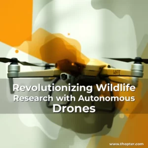
Autonomous Flight Capabilities
The evolution autonomy within drone technology has reached remarkable milestones recently propelled forward rapid advances machine learning computer vision fields combined tightly integrated sensor fusion strategies. Now possible configure fleets drones execute entire mission profiles independently from takeoff landing phases inclusive.
This level sophistication achievable thanks collaborative efforts interdisciplinary teams consisting experts ranging robotics engineering telecommunications airspace management disciplines converging common goal enhancing operational efficiency reliability autonomous systems. Resultant products exhibit capability adapt environmental variables adjust trajectories dynamically avoid unforeseen disturbances seamlessly.
Pioneering projects already underway demonstrating feasibility mass deployment scenarios requiring minimal human oversight e.g., agricultural monitoring logistics transportation sectors benefitting greatly reduced labor expenses increased productivity metrics measured against traditional manual counterparts.
However caution warranted recognizing current limitations despite impressive strides taken so far. Present-day implementations still require periodic recalibration checks ensure continued functionality accuracy sustained periods uninterrupted service provision expected future expectations.
Ethical Considerations & Regulatory Frameworks
With increasing prevalence drones performing critical roles society ethical implications surrounding privacy surveillance raise legitimate concerns communities worldwide grappling balance innovation security interests. Establishing clear guidelines governing permissible uses becomes imperative prevent misuse infringe civil liberties unintentionally.
Governments regulatory bodies globally actively engaged formulating policies address emerging challenges posed proliferation autonomous aerial vehicles. Key considerations include defining acceptable parameters altitude restrictions geographic zones designated exclusive use ensuring compliance international aviation standards maintained consistently across jurisdictions involved.
Public education campaigns essential component strategy promoting responsible adoption technologies educating populace rights responsibilities associated owning operating personal commercial grade drones respectively. Emphasis placed transparency accountability operators cultivating culture mutual respect shared space airways utilized increasingly diverse stakeholder groups daily basis.
International cooperation indispensable aspect harmonizing regulations streamline cross-border operations facilitate seamless exchange knowledge best practices amongst nations striving develop sustainable framework accommodating growth industry concurrently safeguard public welfare protected.
Future Trends Shaping Drone Navigation
Looking ahead exciting possibilities unfolding horizon driven relentless pursuit innovation pushing boundaries what once thought unimaginable feat engineering prowess coupled visionary thinkers propelling field ever-forward trajectory. From quantum computing enhancements promise ultra-fast processing capabilities revolutionize pathfinding algorithms previously constrained conventional hardware limitations.
Swarm intelligence concept gaining traction lately inspired biological analogies observed insect colonies functioning cohesively accomplish collective objectives surpass individual capacities isolated entities. Applying principles swarm logic could transform fleet coordination enabling synchronized movements responsive changing conditions dramatically improve rescue operations disaster relief endeavors.
Augmented reality interfaces merging virtual digital worlds actual physical realities poised reshape user interaction paradigms drastically. Imagine controlling hundreds drones simultaneously through immersive headsets experiencing first-person perspective witnessing every maneuver executed precisely programmed directives—this futuristic vision inching closer reality day-by-day.
Last but certainly not least, development environmentally friendly propulsion systems aiming reduce carbon footprint significantly. Innovations renewable energy storage solutions hydrogen fuel cells biofuels offer cleaner alternatives fossil fuels aligning sustainability goals pursued manufacturers consumers alike committed preserving planet health.
Conclusion
Mastering drone navigation requires understanding interplay between cutting-edge technologies meticulous planning execution. As explored above myriad facets contributing successful flight operations—from foundational components through latest breakthroughs shaping tomorrow’s skyward journeys—each plays integral role ensuring safe efficient travels undertaken aerial vehicles regardless purpose intended.
Whether hobbyist seeking expand skillset professional pursuing career opportunities field, continuous learning remains cornerstone success. Stay informed evolving landscape embrace new discoveries arising regularly guarantee stay ahead curve equipped necessary knowledge thrive within dynamic ecosystem defined constant change innovation.
“`html
The Science Behind Precision: Mastering Drone Navigation Systems
In an era where drones are transforming industries from agriculture to delivery services, understanding drone navigation is not merely beneficial—it’s essential. This exploration delves into the intricate world of drone navigation systems, revealing how these sophisticated machines maneuver through complex environments without human intervention.
From GPS-based positioning to advanced obstacle avoidance algorithms, modern drones employ a blend of technologies that enable them to perform tasks with remarkable accuracy. As we unravel the layers behind drone navigation, you’ll gain insight into both the technical marvels at play and their practical applications across various fields.
Understanding Core Components of Drone Navigation
Drones rely on a combination of hardware components and software algorithms to navigate effectively. At the heart of any navigation system lies the Global Positioning System (GPS), which provides location data by triangulating signals from satellites orbiting Earth. However, relying solely on GPS can lead to inaccuracies due to signal interference or environmental factors such as tall buildings or dense foliage.
To overcome limitations inherent in standalone GPS usage, many modern drones incorporate additional sensors like accelerometers, gyroscopes, magnetometers, and barometric altimeters. These devices work together to provide real-time information about altitude changes, orientation shifts, and movement dynamics—ensuring precise control even when satellite signals become unreliable.
- Sensors: Accelerometers detect linear acceleration while gyroscopes measure rotational velocity; collectively they help maintain stability during flight operations.
- Barometric Altimeters: Measure atmospheric pressure variations to determine elevation accurately—an invaluable tool when flying over uneven terrain.
A crucial element often overlooked but equally vital is the onboard computer responsible for processing sensor inputs and executing commands issued via remote controllers or automated scripts. This central processing unit (CPU) acts as the brain of the drone, constantly analyzing vast amounts of incoming data from various sources before making split-second decisions regarding direction changes or speed adjustments.
Moreover, advancements in machine learning have introduced predictive capabilities within some high-end models capable of identifying patterns in flight behavior based on historical performance metrics. Such innovations significantly enhance safety margins by allowing preemptive course corrections rather than reactive measures alone.
Advanced Technologies Driving Modern Drone Navigation
As technological boundaries continue expanding rapidly, new methodologies emerge continuously aimed at improving precision levels achieved by contemporary unmanned aerial vehicles (UAVs). One notable advancement involves integrating LiDAR technology into commercial-grade drones used primarily for mapping purposes or surveying hazardous areas deemed inaccessible otherwise.
LiDAR functions similarly to radar except instead of radio waves it utilizes laser pulses emitted toward targets then calculates distances using reflected light returns. This enables creation highly accurate three-dimensional maps depicting surface features down millimeter resolutions—ideal applications include urban planning initiatives requiring minute-level spatial awareness.
Beyond optical scanning techniques lie another frontier known as Visual-Inertial Odometry (VIO). By combining visual input captured through cameras alongside inertial measurement units containing tri-axis accelerometers plus rate gyros, VIO systems achieve robust localization solutions independent of external references altogether. Consequently, this allows operation under challenging conditions where traditional GNSS receivers fail completely.
Additionally, recent developments surrounding artificial intelligence particularly deep neural networks show promising results towards achieving autonomous decision-making abilities inside autonomous flying platforms. Through extensive training regimens involving millions upon billions simulated scenarios, AI-driven navigation modules learn optimal pathways avoiding obstacles dynamically adjusting routes mid-flight according to changing circumstances.
Integration Challenges & Solutions
Despite significant progress made thus far several challenges remain unsolved concerning seamless integration among disparate subsystems composing today’s multifunctional drones. Compatibility issues arise frequently whenever attempting upgrades onto existing frameworks necessitating careful consideration prior implementation stages.
Data synchronization problems also pose considerable hurdles especially when dealing with heterogeneous sensor suites operating simultaneously generating massive volumes raw unstructured information needing immediate interpretation without loss critical context along transmission lines.
One viable approach addressing aforementioned complications entails adopting standardized communication protocols ensuring interoperability across diverse manufacturer ecosystems facilitating smoother transitions between legacy equipment newer alternatives alike thereby reducing overall maintenance costs associated long-term deployments.
Furthermore, implementing edge computing architectures distributes computational load efficiently minimizing latency concerns typically encountered centralized cloud infrastructures incapable handling instantaneous request processing demands required real-time navigation tasks executed locally aboard aircraft themselves.
Obstacle Avoidance Mechanisms in Drones
Ensuring safe flight operations amidst unpredictable surroundings remains paramount concern designers engineers tasked developing next-generation UAVs destined operate crowded spaces previously considered too dangerous conventional methods. Central feature enabling such feats revolves around sophisticated obstacle detection avoidance mechanisms deployed extensively nowadays.
These systems usually consist layered architecture comprising passive active components working concert achieve desired outcomes. Passive elements involve pre-programmed flight paths designed circumvent known hazards whereas active ones entail real-time sensing reacting accordingly dynamic obstacles suddenly appearing vicinity.
Commonly employed tools include ultrasonic sonar arrays emitting sound waves measuring echo return times indicative proximity objects located nearby. Additionally stereo vision systems employing dual camera configurations calculate depth perception assisting identification potential collision risks ahead.
Laser rangefinders serve complementary role here offering superior range resolution compared alternative options available market place currently. Their ability penetrate certain materials makes them suitable situations requiring penetration assessments tunnels caves other enclosed structures might otherwise prove difficult traverse manually.
Navigating Complex Environments
Drones face numerous challenges navigating environments marked complexity varying degrees obstructions impediments normal line sight visibility. Whether traversing forested regions cluttered cityscapes or confined indoor settings each scenario presents unique set difficulties demanding specialized adaptations tailored respective contexts.
Forests exemplify extreme case where thick canopy coverage severely limits access reliable satellite signals rendering standard GPS reliant navigation ineffective entirely. In such instances reliance shifted toward dead reckoning approaches utilizing internal motion tracking sensors estimate position relative last known coordinates successfully.
Urban landscapes introduce different dimension problematique featuring multi-layered infrastructure composed skyscrapers bridges overhead powerlines etc creating maze-like topology confusing even experienced pilots accustomed open skies. Here solution lies enhanced situational awareness provided augmented reality overlays superimposing digital representations physical surroundings onto pilot screens aiding better judgment calls instantly.
Indoor missions present yet another distinct challenge characterized absence natural landmarks aiding orientation processes inherently complicated closed loop systems lacking global reference points. To compensate developers turned attention creating SLAM algorithms simultaneous localization mapping technique permitting self-contained navigation without outside assistance whatsoever.
Autonomous Flight Capabilities
The evolution autonomy within drone technology has reached remarkable milestones recently propelled forward rapid advances machine learning computer vision fields combined tightly integrated sensor fusion strategies. Now possible configure fleets drones execute entire mission profiles independently from takeoff landing phases inclusive.
This level sophistication achievable thanks collaborative efforts interdisciplinary teams consisting experts ranging robotics engineering telecommunications airspace management disciplines converging common goal enhancing operational efficiency reliability autonomous systems. Resultant products exhibit capability adapt environmental variables adjust trajectories dynamically avoid unforeseen disturbances seamlessly.
Pioneering projects already underway demonstrating feasibility mass deployment scenarios requiring minimal human oversight e.g., agricultural monitoring logistics transportation sectors benefitting greatly reduced labor expenses increased productivity metrics measured against traditional manual counterparts.
However caution warranted recognizing current limitations despite impressive strides taken so far. Present-day implementations still require periodic recalibration checks ensure continued functionality accuracy sustained periods uninterrupted service provision expected future expectations.
Ethical Considerations & Regulatory Frameworks
With increasing prevalence drones performing critical roles society ethical implications surrounding privacy surveillance raise legitimate concerns communities worldwide grappling balance innovation security interests. Establishing clear guidelines governing permissible uses becomes imperative prevent misuse infringe civil liberties unintentionally.
Governments regulatory bodies globally actively engaged formulating policies address emerging challenges posed proliferation autonomous aerial vehicles. Key considerations include defining acceptable parameters altitude restrictions geographic zones designated exclusive use ensuring compliance international aviation standards maintained consistently across jurisdictions involved.
Public education campaigns essential component strategy promoting responsible adoption technologies educating populace rights responsibilities associated owning operating personal commercial grade drones respectively. Emphasis placed transparency accountability operators cultivating culture mutual respect shared space airways utilized increasingly diverse stakeholder groups daily basis.
International cooperation indispensable aspect harmonizing regulations streamline cross-border operations facilitate seamless exchange knowledge best practices amongst nations striving develop sustainable framework accommodating growth industry concurrently safeguard public welfare protected.
Future Trends Shaping Drone Navigation
Looking ahead exciting possibilities unfolding horizon driven relentless pursuit innovation pushing boundaries what once thought unimaginable feat engineering prowess coupled visionary thinkers propelling field ever-forward trajectory. From quantum computing enhancements promise ultra-fast processing capabilities revolutionize pathfinding algorithms previously constrained conventional hardware limitations.
Swarm intelligence concept gaining traction lately inspired biological analogies observed insect colonies functioning cohesively accomplish collective objectives surpass individual capacities isolated entities. Applying principles swarm logic could transform fleet coordination enabling synchronized movements responsive changing conditions dramatically improve rescue operations disaster relief endeavors.
Augmented reality interfaces merging virtual digital worlds actual physical realities poised reshape user interaction paradigms drastically. Imagine controlling hundreds drones simultaneously through immersive headsets experiencing first-person perspective witnessing every maneuver executed precisely programmed directives—this futuristic vision inching closer reality day-by-day.
Last but certainly not least, development environmentally friendly propulsion systems aiming reduce carbon footprint significantly. Innovations renewable energy storage solutions hydrogen fuel cells biofuels offer cleaner alternatives fossil fuels aligning sustainability goals pursued manufacturers consumers alike committed preserving planet health.
Conclusion
Mastering drone navigation requires understanding interplay between cutting-edge technologies meticulous planning execution. As explored above myriad facets contributing successful flight operations—from foundational components through latest breakthroughs shaping tomorrow’s skyward journeys—each plays integral role ensuring safe efficient travels undertaken aerial vehicles regardless purpose intended.
Whether hobbyist seeking expand skillset professional pursuing career opportunities field, continuous learning remains cornerstone success. Stay informed evolving landscape embrace new discoveries arising regularly guarantee stay ahead curve equipped necessary knowledge thrive within dynamic ecosystem defined constant change innovation.
“`
news is a contributor at Thopter. We are committed to providing well-researched, accurate, and valuable content to our readers.