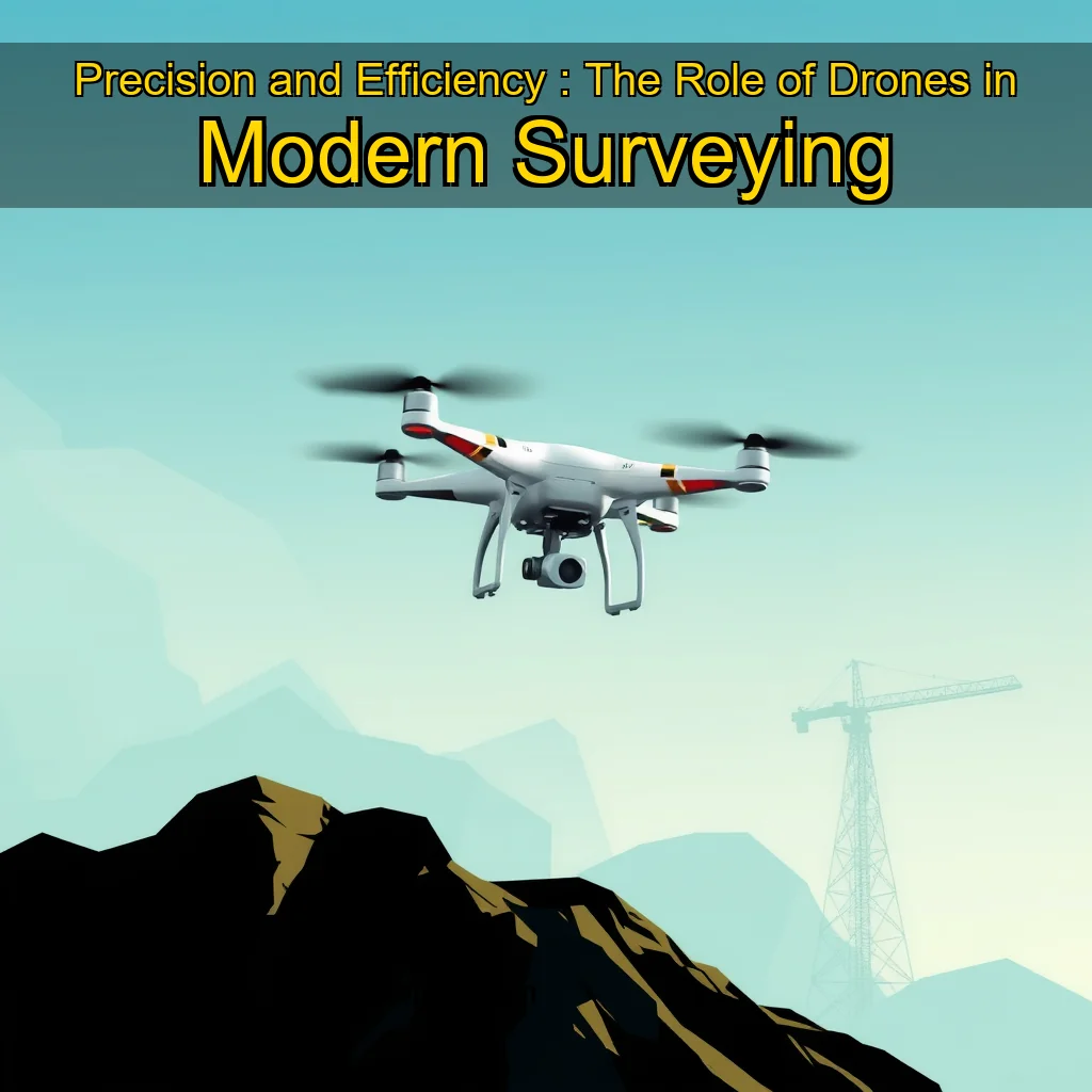
Drone technology is revolutionizing the surveying industry with its efficiency, accuracy, and safety benefits.
The Rise of Drone Technology in Surveying
The use of drones in surveying has gained significant traction in recent years, with many companies and organizations adopting this innovative technology to streamline their surveying processes. The benefits of using drones in surveying are numerous, and this article will delve into the ways in which drone technology is revolutionizing the industry.
Advantages of Drone Technology
Increased Efficiency: Drones can cover large areas quickly and accurately, reducing the time and cost associated with traditional surveying methods. Improved Accuracy: High-resolution cameras and GPS capabilities enable drones to capture precise measurements and data, reducing errors and increasing accuracy. Enhanced Safety: Drones can operate in hazardous environments, such as hard-to-reach areas or areas with limited access, reducing the risk of injury to surveyors. ### Applications of Drone Technology**
Applications of Drone Technology
Land Surveying: Drones are being used to map and survey land, including topography, boundaries, and property lines. Infrastructure Inspection: Drones are being used to inspect and monitor infrastructure, such as bridges, roads, and buildings. Environmental Monitoring: Drones are being used to monitor and track environmental changes, such as deforestation, wildlife populations, and water quality.
This allows for efficient and cost-effective mapping and land valuation.
The Rise of Drone Surveying
Drone surveying has gained significant traction in recent years, driven by advancements in technology and decreasing costs. The use of drones has expanded beyond traditional surveying applications, such as mapping and land valuation, to include other fields like construction, agriculture, and environmental monitoring.
Advantages of Drone Surveying
Cost-effectiveness: Drone surveying is significantly cheaper than traditional surveying methods, making it an attractive option for large-scale projects. Speed: Drones can cover vast areas quickly, reducing the time and effort required for data collection. Accuracy: Advanced sensors and software enable high-accuracy data collection, comparable to traditional methods. * Flexibility: Drones can operate in areas inaccessible to traditional surveying methods, such as remote or hard-to-reach locations. ## Applications of Drone Surveying**
Applications of Drone Surveying
Drone surveying has numerous applications across various industries, including:
Construction: Monitoring site progress, inspecting infrastructure, and detecting defects. Agriculture: Crop monitoring, soil analysis, and precision farming. Environmental Monitoring: Tracking wildlife populations, monitoring water quality, and detecting natural disasters. * Land Valuation: Mapping land boundaries, assessing property values, and identifying development opportunities. ## The Future of Drone Surveying**
The Future of Drone Surveying
As technology continues to advance, drone surveying is expected to play an increasingly important role in various industries.
The Benefits of Drones in Topographic Mapping
Drones have revolutionized the field of topographic mapping by providing unparalleled accuracy and efficiency. Here are some of the key benefits of using drones in topographic mapping:
High-resolution elevation data: Drones equipped with high-resolution sensors can capture detailed elevation data, allowing for accurate mapping of complex terrain. Wide coverage: Drones can cover large areas quickly, making them ideal for mapping vast regions such as mountains, forests, and coastlines. Low cost: Compared to traditional surveying methods, drone-based topographic mapping is relatively inexpensive, reducing costs for mapping large areas. * Increased accuracy: Drones can capture data with high accuracy, reducing the need for manual measurements and minimizing errors. ## The Process of Drone-Based Topographic Mapping**
The Process of Drone-Based Topographic Mapping
The process of drone-based topographic mapping involves several steps:
Pre-flight planning: Before taking off, pilots must plan the flight path, taking into account factors such as weather conditions, terrain, and obstacles.
Harnessing the Power of Drones for Efficient and Cost-Effective Surveys.
These setups can capture high-resolution images and 3D point clouds, which can be used to create detailed maps and models of the area being surveyed.
The Benefits of Using Drones for Surveys
Improved Efficiency
Reduced survey time: Drones can cover large areas quickly, reducing the time required for surveys. Increased accuracy: Drones can capture high-resolution images and 3D point clouds, which can be used to create accurate maps and models. Enhanced data collection: Drones can collect data in areas that are difficult or impossible for humans to access. ## The Cost-Effectiveness of Drones for Surveys**
The Cost-Effectiveness of Drones for Surveys
Reduced Costs
Lower equipment costs: Drones and photogrammetry setups are relatively affordable, with prices ranging from a few thousand dollars. Reduced labor costs: Drones can automate many tasks, reducing the need for human labor. Increased productivity: Drones can work around the clock, increasing productivity and reducing downtime. ## The Safety Benefits of Using Drones for Surveys**
The Safety Benefits of Using Drones for Surveys
Improved Safety
Reduced risk of injury: Drones can capture data from a safe distance, reducing the risk of injury to surveyors.
The Benefits of Using Drones in Geospatial Data Collection
Drones have revolutionized the way geospatial data is collected, offering numerous benefits over traditional methods. Some of the advantages of using drones in geospatial data collection include:
Increased Efficiency: Drones can cover large areas quickly and accurately, reducing the time and cost associated with traditional surveying methods. Improved Accuracy: High-resolution cameras and LiDAR sensors provide detailed and accurate data, reducing the need for manual measurements and minimizing errors. Enhanced Safety: Drones can operate in challenging environments, reducing the risk of injury or death to surveyors. * Cost-Effective: Drones are often more cost-effective than traditional surveying methods, especially for large-scale projects. ## The Role of Drones in Environmental Monitoring**
The Role of Drones in Environmental Monitoring
Drones are increasingly being used in environmental monitoring, providing valuable insights into the health of our planet. Some of the ways drones are used in environmental monitoring include:
Air Quality Monitoring: Drones equipped with sensors can monitor air quality, detecting pollutants and tracking changes in atmospheric conditions. Wildlife Conservation: Drones can be used to track wildlife populations, monitor habitat health, and detect signs of poaching or habitat destruction. Climate Change Research: Drones can be used to study climate change by monitoring sea level rise, tracking glacier movement, and detecting changes in vegetation patterns.
Precision agriculture is a method of farming that uses technology to optimize crop yields and reduce waste. It involves the use of sensors, drones, and satellite imaging to monitor and manage crops.
The Rise of Drone Technology in Aerial Photography
The use of drones in aerial photography has become increasingly popular in recent years. This is due to the numerous benefits that drones offer, including increased efficiency, reduced costs, and improved accuracy. In this article, we will explore the ways in which drones are transforming the field of aerial photography.
Benefits of Drone Technology
Increased efficiency: Drones can capture high-quality aerial images and videos in a fraction of the time it would take using traditional methods. Reduced costs: Drones are often less expensive than traditional aerial photography methods, making them a more accessible option for businesses and individuals.
The Benefits of Drones in Search and Rescue Operations
Drones have revolutionized the way search and rescue teams operate, providing a cost-effective and efficient solution to locate missing persons. Here are some key benefits of using drones in search and rescue missions:
Increased coverage area: Drones can cover large areas quickly, allowing search teams to focus on specific locations and reduce the time spent searching. Improved visibility: Drones equipped with high-resolution cameras can capture detailed images of the search area, helping teams to identify potential locations of missing persons. Enhanced safety: Drones can navigate through hazardous terrain, reducing the risk of injury or death for search teams. * Reduced costs: Drones can be used to reduce the number of personnel required for search and rescue operations, resulting in cost savings. ## Case Study: The Use of Drones in the Nepal Earthquake**
Case Study: The Use of Drones in the Nepal Earthquake
In 2015, a devastating earthquake struck Nepal, resulting in widespread destruction and loss of life. The Nepalese government used drones to locate missing persons in the affected areas. The drones were equipped with thermal imaging cameras, which allowed them to detect heat signatures from survivors. This technology enabled search teams to locate survivors in rubble and debris, saving countless lives.
The Role of Drones in Wildlife Conservation
Drones are also being used in wildlife conservation efforts to track and monitor animal populations without disrupting their natural habitats. Here are some ways drones are being used in wildlife conservation:
Monitoring wildlife populations: Drones equipped with cameras and sensors can track animal populations, providing valuable insights into their behavior, habitat, and population dynamics.
Drone delivery is revolutionizing the logistics industry with its speed, cost-effectiveness, and environmental benefits.
The Rise of Drone Delivery
The use of drones for delivery purposes is gaining momentum, with logistics firms and e-commerce entrepreneurs exploring its potential. The primary advantage of drone delivery is its speed, which can be significantly faster than traditional methods. According to a study, drones can deliver small parcels in as little as 30 minutes, while traditional delivery methods can take up to several hours.
Benefits of Drone Delivery
Increased Speed: Drone delivery can significantly reduce delivery times, making it ideal for time-sensitive packages. Cost-Effective: Drones can reduce fuel costs and lower labor expenses, making it a more cost-effective option. Environmental Benefits: Drone delivery can reduce carbon emissions and minimize the environmental impact of traditional delivery methods. ## The Medical Sector’s Potential**
The Medical Sector’s Potential
The medical sector is particularly well-suited for drone delivery, as it can revolutionize the way medical supplies are transported. Drones can quickly deliver critical medical supplies, such as blood, vaccines, and medications, to remote or hard-to-reach areas.
Challenges and Limitations
Regulatory Framework: The use of drones for delivery purposes is still largely unregulated, and there are concerns about safety and security. Technical Challenges: Drones require specialized equipment and training, and technical issues can arise during flight. Public Acceptance: There may be concerns about the safety and reliability of drone delivery, which can impact public acceptance. ## The Future of Drone Delivery**
The Future of Drone Delivery
As the technology continues to evolve, we can expect to see significant advancements in drone delivery.
Their widespread adoption has led to numerous benefits, including improved crop monitoring, enhanced disaster response, and increased productivity in industries such as construction and agriculture.
The Rise of Drones in Agriculture
Agriculture is one of the primary sectors where drones have made a significant impact. By leveraging drone technology, farmers can monitor crop health, detect pests and diseases, and optimize irrigation systems. This increased efficiency has led to improved crop yields and reduced waste. Key benefits of drone technology in agriculture:
- Improved crop monitoring and health assessment
- Enhanced pest and disease detection
- Optimized irrigation systems
- Reduced waste and increased productivity
For instance, a study by the University of California, Davis, found that drones equipped with multispectral cameras can detect crop stress and disease more accurately than traditional methods.
news
news is a contributor at Thopter. We are committed to providing well-researched, accurate, and valuable content to our readers.